Discover Canada and Explore the Fossils and Geodiversity of Herschel Island in the Yukon
- Oct 4, 2025
- 4 min read
Updated: Dec 18, 2025
Sip back and discover Canada and explore the fossils and geodiversity of Herschel Island or Qikiqtaruk located off the northern Yukon coast in the Beaufort Sea that preserves a unique Arctic landscape from the Pleistocene. Unlike Alaska’s nearby Prince Creek Formation of the North Slope that preserves polar dinosaurs, Herschel Island’s vertebrate record reflects Pleistocene mammals adapted to long winters and glacial cycles. Formed around 30,000 years ago during the Wisconsin Glaciation. Herschel Island consists entirely of glacial deposits formed of ice rich Yedoma permafrost that records past steppe-tundra environment. Coastal erosion continually exposes well-preserved Ice Age fossils including Woolly Mammoths, Yukon Horses, Steppe Bison, Muskoxen, and American Mastodons alongside plant remains and pollen indicating a “mammoth steppe” ecosystem. Herschel Island forms part of the Qikiqtaruk Territorial Park and together with Ivvavik and Vuntut National Parks, protects over 15,500 Km² of Beringian wilderness including the Yukon Coastal Plain, Old Crow Flats and Richardson Mountains. This region served as ice-free refugia enabling plant and animal survival maintaining genetic diversity and supporting human migration across the Bering Land Bridge.

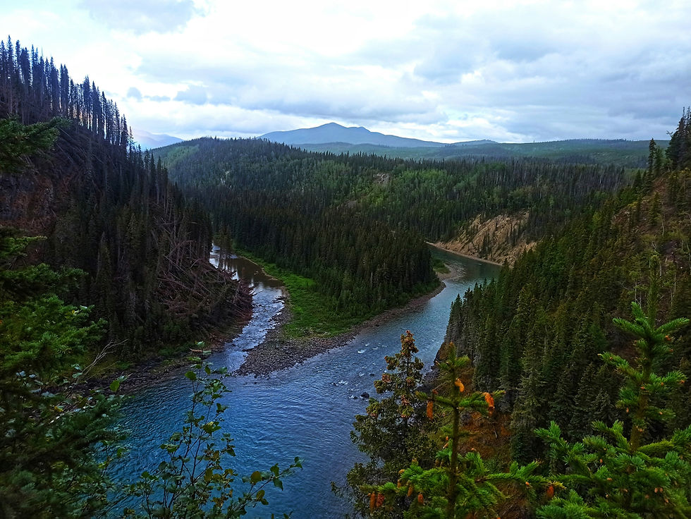
Herschel Island or Qikiqtaruk is situated off the northern coast of Canada’s Yukon Territory in the Beaufort Sea. Herschel Island is culturally and historically important as a former 19th-century whaling station whose natural heritage and indigenous Inuvialuit history of the area is protected by the Qikiqtaruk Territorial Park. Covering roughly 110 Km² and rising just 183 meters above sea level the island sits approximately five kilometers off the Yukon mainland between Alaska’s Point Barrow and the Mackenzie River Delta.
The permafrost on Herschel Island and particularly the Yedoma layers that are also found in Siberia and Alaska are thick ice-rich permafrost deposits from the Pleistocene and preserve vast stores of undecomposed ancient carbon. When it thaws, the melting ground ice causes thermokarst collapse while decomposition of the organic matter releases large amounts of carbon dioxide and methane making Yedoma a critical climate feedback system with major implications for global warming.

The permafrost was formed under periglacial conditions near to the glacier margin where the cold conditions of an arid steppe-tundra accumulated tens of meters of ground ice over tens of thousands of years. Buried ice wedges, interbedded peat and silty sediments record past permafrost dynamics and steppe vegetation while ongoing coastal erosion continually exposes new fossils.

Herschel Island along with the Ivvavik National Park and Vuntut National Park together protect over 15,500 km² of wilderness on the Yukon Coastal Plain, Richardson Mountains, the wetlands of Old Crow Flats and the Beaufort Sea. This unglaciated region is part of the ancient Beringia corridor.

This wilderness features major rivers, canyons and the internationally recognised Ramsar-listed Old Crow Flats a wetland plain of more than 2,000 freshwater lakes formed by shallow depressions left by melting ice-blocks are a critical breeding ground for many migrating waterfowl species such as Canvasback, American Wigeon, Pintail, Scaup, Surf Scoter, White-Winged Scoter, Tundra Swan, White-Fronted Goose, various Loons and birds of prey like the Peregrine Falcon, Bald Eagles and Ospreys.

This area sustains a diverse wildlife including three bear species, Dall Sheep, Moose and nearly 10% of the world’s Caribou, especially the Porcupine Herd, named after the Porcupine River, is one of the largest migratory barren-ground caribou herds that undertakes the world’s longest land migration between its Arctic Coastal Plain calving grounds and mountain wintering areas across Alaska, Yukon and the Northwest Territories. Culturally, this area is the homeland of the Inuvialuit the descendants of the Thule migration from Alaska and the First Nation people of Vuntut Gwitchin.
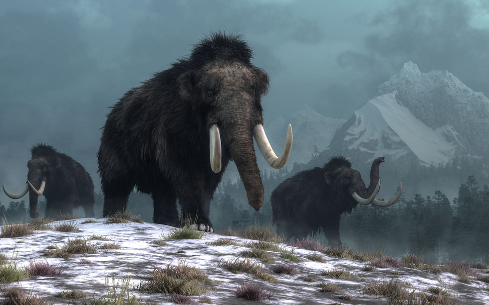
Herschel Island's fossil record is exposed at places such as Pauline Cove and other eroding bluffs that have yielded well-preserved remains of megafauna including woolly mammoths (Mammuthus primigenius), Yukon horses (Equus sp.), Steppe Bison (Bison priscus), Muskoxen and American mastodons (Mammut americanum).

Herschel Island preserves exceptionally well plants, including steppe grasses, herbs and pollen that tell a story of a Pleistocene “mammoth steppe” once part of Earth’s largest biome. Stretching across northern Eurasia and North America, this ecosystem once supported abundant herbivorous megafauna despite its cold and arid conditions. Fossil evidence, including bird, fish and insect remains reveals the ecological complexity of this Arctic glacial landscape where mammals, not dinosaurs, dominated and were adapted to extreme conditions of winter darkness, freeze-thaw cycles and glacial–interglacial periods.
Herschel Island was formed around 30,000 years ago during the Wisconsin Glaciation of the last ice age that shaped the Yukon and northwestern Canada during the late Pleistocene. This was when a lobe of the Laurentide Ice Sheet advanced westward from the Mackenzie River valley uplifting and pushing marine and coastal sediments from the Beaufort Sea coastal plain into a large push moraine that now makes up the island.
The lowlands such as the Yukon Coastal Plain and Old Crow Flats remained unglaciated and acted as an ice-free refugia that served as a stable ecosystem where plants and animals could survive, maintain genetic diversity and provide a source for post-glacial recolonisation. As part of Beringia this ice-free region connected Siberia and Alaska during glacial periods serving as a crucial corridor for the migration of animals and humans between Asia and North America. Exposed when sea levels dropped during the Pleistocene the Bering Land Bridge stretched from the Lena River in Russia to the Mackenzie River in Canada.
Herschel Island’s fossils continue to be revealed through the thawing of the permafrost and the erosive action of the Beaufort Sea.