Discover Canada and Explore the Fossils and Geodiversity of the Niagara Escarpment in Ontario
- Wayne Munday
- Oct 21, 2025
- 5 min read
Updated: Dec 19, 2025
The Niagara Escarpment of southern Ontario stretches over 725 kilometres from Queenston near Niagara Falls through Hamilton, Collingwood and the Bruce Peninsula to Tobermory. Composed mainly of Silurian dolostone and limestone of the Lockport, Rochester and Grimsby formations this ancient ridge records nearly half a billion years of Earth history. Formed by differential erosion of the hard dolostone over softer shales and sandstones the escarpment features dramatic cliffs, waterfalls and caves that define the region’s rugged landscape. Originally, deposited in tropical seas bordering the ancient continent Laurentia these rocks preserve a remarkable fossil record of corals, trilobites, crinoids and brachiopods revealing the marine ecosystems of the Ordovician and Silurian periods. The Lockport Formation, which forms the caprock of Niagara Falls, and the Eramosa Lagerstätte near Hamilton and Wiarton showcase exceptional fossil preservation. Today, the escarpment’s karst landscapes, biodiversity, and fossil sites make it both a UNESCO Biosphere Reserve and a must-visit destination.

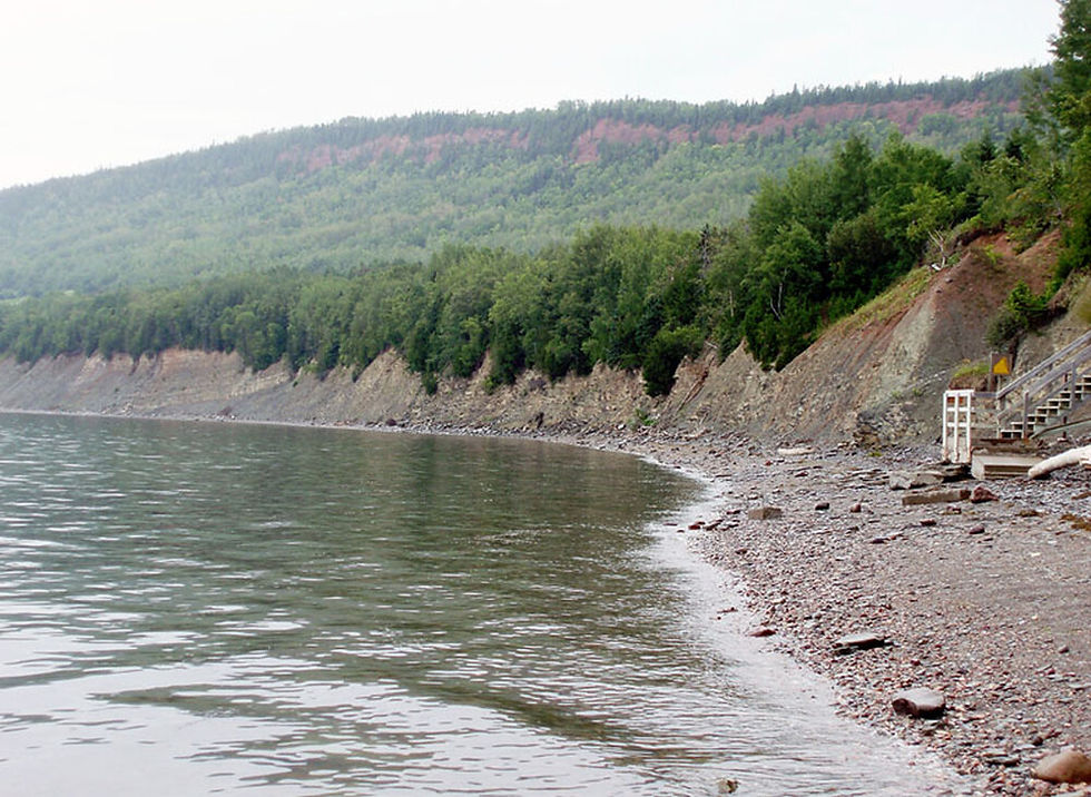
The Niagara Escarpment in Ontario is a sweeping Silurian-aged ridge of dolostone and limestone that arcs more than 725 Km from Queenston near Niagara Falls north west through Hamilton, Milton, Georgetown, Orangeville, Collingwood and the Owen Sound onto the small harbour village of Tobermory on the northern tip of the Bruce Peninsula on Georgian Bay. At Queenston Heights the escarpment forms the dramatic drop of Niagara Falls. Further west it carves out steep and wooded slopes through Halton Hills and Caledon. North of Collingwood it rises into the Blue Mountains and limestone bluffs overlooking Georgian Bay then traces the Bruce Peninsula’s cliffs and caves within the Niagara Escarpment UNESCO Biosphere Reserve that supports over 300 bird species, 55 mammals and 100 rare plant varieties making it Canada’s most biologically rich biosphere reserve. The Niagara Escarpment continues by disappearing beneath Lake Huron and reemerging near Manitoulin Island. Underlain by softer shales and sandstones the process of differential erosion has produced waterfalls, karst formations and diverse ecosystems. The escarpment’s distinctive topography makes it a defining landform of southern Ontario.
The Niagara Escarpment is not a fault or a feature of tectonic uplift but rather the escarpment is a cuesta or a ridge formed by gently dipping sedimentary rocks where one side slopes gradually while the other forms a steep scarp. The Niagara Escarpment reflects the steady natural erosion of layered rocks rather than any abrupt geological upheaval.

The foundations of the Niagara Escarpment is an ancient seafloor dating back to the Middle to Upper Ordovician Period. This was a time when this region was part of Laurentia and lay beneath the warm and tropical Iapetus Ocean near to the equator in the southern hemisphere. Sediments derived from the erosion of the Taconic Mountains to the east were deposited into the Michigan Basin forming alternating layers of mud, sand and carbonate minerals. Over millions of years, these sediments of shale, sandstone, limestone and dolostone compacted into distinct formations that would later become the building blocks of the escarpment.
The Niagara Escarpment has a complex history where the sequence of rock formations and fossil assemblages spans from the Late Ordovician to the Silurian Period and tells a story of a dramatic transition from deltaic river system to the transgression of a warm tropical sea that once fringed the ancient continent of Laurentia.
At its base lies the Queenston Formation a red shale sequence deposited in a Taconic foreland delta. Ripple marks, mud cracks and fossils such as trilobites, brachiopods and the vertical U-shaped trace fossil of Diplocraterion burrows reveal an intertidal shoreline where the sea and land met.

As global sea levels rose during the early Silurian the Grimsby and Thorold formations marked a major marine transgression linked to the retreat of glacial ice and the expansion of the Iapetus Ocean. These sandstones and shales record the shift from a tidal foreshore environment to a near shore sea with fossils of snail like Tritonophon grimsbyensis, brachiopods and bryozoans testifying to thriving ecosystems in newly flooded coastal waters. These formations also have seismites where the sediments have been deformed by seismic shaking characterised by highly convoluted bedding that reflect the tectonic restlessness of the Appalachian foreland basin where earthquakes and subsidence reshaped the seafloor.

Grimsby Formation: A) Bivalve burrows, B) Bivalve shells and a bellerophont specimen (arrowed), C) Ramose bryozoans, small bivalves, a few bellerophonts, D) Bivalves, fragments of ramose bryozoans and small burrows, and numerous bellerophonts, E) Bellerophonts and small burrows, numerous bivalves and a small nautiloid (lower right corner), F) Many bellerophonts
The overlying Rochester and Lockport formations capture the rise of extensive Silurian reef systems of early coral, crinoid and stromatoporoid communities that built vast carbonate platforms. The Lockport Formation, a hard erosion-resistant dolostone caprock, known for forming Niagara Falls and the escarpment’s cliffs preserves exquisite reef fossils, particularly within the Gasport and Eramosa members. The Eramosa Lagerstätte near Wiarton, Hamilton and the Bruce Peninsula is world-renowned for its exceptional preservation of soft-bodied Silurian Sea Scorpions, arthropods, crustaceans, soft-bodied worms, algae and typical reef taxa such as crinoids, bryozoans and corals often showing appendages and internal anatomy.

Through millions of years of erosion, glacial carving and karst dissolution the escarpment has evolved into the spectacular landscape of cliffs, gorges and caves. During the Pleistocene Epoch Canada was covered multiple times by glaciers. In Ontario part of the large Laurentide Ice Sheet profoundly shaped the provinces landscape through erosion and deposition from repeated glacial advancing and retreating. As the ice sheets melted vast torrents of meltwater carved valleys and the land began to rebound isostatically as the weight of the ice reduced.
Although no dinosaur fossils have been found in the escarpment the region does contain later Pleistocene deposits where fossils of Mastodons, Woolly Elephants, Deer and Bears have been discovered in unconsolidated glacial and post-glacial sediments. Interestingly, Mastodon remains are widespread across North America but are most common in the Great Lakes region at the end of the Pleistocene. Their fossils are typically found in coniferous forests, bogs, and marshes, particularly those dominated by spruce.
The karst landscape of the Niagara Escarpment is particularly prominent across the Bruce Peninsula and Manitoulin Island. Formed by the slow dissolution of slightly acidic rainwater and groundwater in the fractures and bedding planes over millions of years in the Lockport Formation. This terrain has karst topography of sinkholes, caves, disappearing streams, klint and gryke pavement and underground drainage systems.

On the Bruce Peninsula are Greig’s Caves and Bruce’s Caves while on Manitoulin Island there are also several caves including Mindemoya Cave also known as Skeleton Cave at Bridal Veil Falls. Among the features are extensive doline fields of bowl shaped depressions and subterranean channels. These hidden landscapes of cool shaded crevices sustain unique microclimates and ecosystems.