Discover Canada and Explore its Fossils, Dinosaurs and Geodiversity
- Wayne Munday
- Oct 21, 2025
- 11 min read
Updated: Dec 17, 2025
Sip back and discover Canada and explore an unparalleled journey through deep time where dramatic landscapes and rich fossil records showcase the evolution of life across millions of years. In Nova Scotia, the Cliffs of Fundy UNESCO Global Geopark and sites like Blue Beach and Joggins Fossil Cliffs reveal Devonian to Carboniferous ecosystems, preserving early tetrapod footprints, amphibians, reptiles and plant fossils within tidal estuaries, delta's and tropical swamps. Newfoundland’s Bonavista Peninsula captures some of the oldest multicellular life with Ediacaran fossils such as Rangeomorphs, Aspidella and Haootia illuminating pre-Cambrian marine communities. Alberta’s Dinosaur Provincial Park, Fort McMurray and Cypress Hills expose Mesozoic dinosaurs, prosauropods, ceratopsians and an armoured Borealopelta alongside diverse early mammals illustrating the Triassic to Cretaceous terrestrial and marine transitions. British Columbia preserves exceptional Cambrian Burgess Shale fauna, Cretaceous dinosaur trackways at Tumbler Ridge and marine fossils on Hornby Island, while Quebec’s Miguasha National Park and Percé UNESCO Global Geopark document the fish-to-tetrapod transition and Paleozoic marine ecosystems. Saskatchewan, Manitoba, Nunavut and Yukon reveal Arctic vertebrates, Late Cretaceous dinosaurs and Ice Age megafauna such as woolly mammoths providing insights into climate change and evolution in high-latitude ecosystems.

Canada’s geology spans over four billion years and reveals a landscape shaped by tectonic collisions, volcanic activity, glaciation and vast accumulation of sedimentation. The country sits atop the Canadian Shield, a Precambrian craton preserving some of Earth’s oldest rocks, including granite, gneiss and greenstone belts.

The western Cordillera tells a story of mountain-building, volcanism and the accretion of terranes while the Appalachian's in the east preserves Paleozoic fold belts and fossil rich sedimentary strata. Canada’s sedimentary basins such as the Western Interior Basin contain rich deposits of fossils, coal and hydrocarbons and the ice ages of Pleistocene has sculpted valleys, moraines and the Great Lakes to shape the modern topography that is Canada today.
Alberta
Discover Canada and Explore the Fossils and Geodiversity of Fort McMurray in Alberta
Fort McMurray in north east Alberta, set along the Athabasca River, reveals a remarkable Early Cretaceous record beneath the vast Athabasca Oil Sands. The Wabiskaw–McMurray succession preserves ancient river, estuarine and shallow marine environments deposited between 125 and 110 million years ago. These sediments not only formed one of the world’s largest bitumen reserves but also entombed fossils of ichnofossils like Skolithos and Thalassinoides and rare vertebrates such as the armored dinosaur Borealopelta markmitchelli and marine reptiles Nichollssaura borealis and Athabascasaurus bitumineus.
Discover Canada and Explore the Fossils and Geodiversity of Cypress Hills in Alberta and Saskatchewan
Cypress Hills straddles south east Alberta and south west Saskatchewan as a towering erosional plateau protected by the resistant Cypress Hills Formation preserving an exceptional fossil record. Recording the retreat of the Western Interior Seaway from the Late Cretaceous into the early Tertiary the region’s conglomerates, sandstones and gravels were deposited by braided rivers and concentrated fossils in channel-lag deposits. Beneath the caprock lie dinosaur-bearing Frenchman Formation beds and an outstanding Oligocene–Miocene mammal fauna of early horses (Mesohippus, Parahippus), camels, brontotheres, entelodonts and carnivores while Calf Creek near Eastend yields a diverse herpetofauna. Surviving as a Pleistocene nunatak, Cypress Hills now supports forests, wildflower meadows and is a Dark-Sky protected landscape.
Discover Canada and Explore the Fossils of the Dinosaur Provincial Park in Alberta
The badlands and hoodoo's of Dinosaur Provincial Park in Alberta is a UNESCO World Heritage Site near Drumheller and preserves one of the world’s richest Late Cretaceous fossil landscapes spanning the Campanian Stage along the Western Interior Seaway. The park’s Belly River Group captures a transition from coastal and riverine Foremost and Oldman formations to the vegetated floodplains of the Dinosaur Park Formation is home to abundant articulated dinosaur skeletons, Centrosaurus bonebeds, hadrosaurs, ceratopsians, ankylosaurs and theropods. Capping the sequence is the Bearpaw Formation that records marine transgressions with ammonites, mosasaur coprolites and iridescent ammolite.
British Columbia
Discover Canada and Explore the Fossils and Geodiversity of Hornby Island in British Columbia
Hornby Island is a small Gulf Island off eastern Vancouver Island in British Columbia and offers a striking fusion of coastal beauty and deep geological history. Its cliffs and beaches expose the Late Cretaceous Nanaimo Group deposited between 92 and 65 million years ago in a marine forearc basin between the Wrangellia terrane and North America. These fossil-rich sandstones and mudstones reveal ammonites like Pachydiscus and Nostoceras, bivalves, gastropods, shark teeth and rare vertebrates such as the diving bird Maaqwi cascadensis. This is an island sculpted by tectonic uplift, glaciation and tafoni weathering.
Discover Canada and Explore the Fossils and Dinosaurs of Tumbler Ridge in British Columbia
Tumbler Ridge UNESCO Global Geopark in northeastern British Columbia spans 8,478 km² of the Hart Ranges preserving an extraordinary fossil record from the Cambrian to the Cretaceous. The Misinchinka and Gog groups reveal early marine environments and ichnofossils like Cruziana, while the Palliser and Rundle formations preserve Devonian and Mississippian coral reefs, trilobites and karst landscapes. Triassic Sulphur Mountain deposits document marine recovery after the Permian–Triassic extinction, including fish and marine reptiles. The geopark is globally renowned for its Cretaceous dinosaur footprints with sites like Flatbed Creek and Wolverine River preserving ornithopod, theropod and ankylosaur trackways, as well as skeletal remains of Boreonykus, Albertosaurus and the nearly complete “Tumbler Ridge Hadrosaur”.
Discover Canada and Explore the Fossils and Geodiversity of the Burgess Shale of British Columbia
The Burgess Shale in Yoho National Park, British Columbia is a world-class Cambrian fossil site preserving an exceptional record of Middle Cambrian marine life from approximately 508 million years ago. Part of the Stephen Formation its soft-bodied fossils including Marrella, Hallucigenia, Pikaia and Opabinia reveal insights into the Cambrian Explosion and the early evolution of animal complexity. Exceptional Burgess Shale-Type preservation resulted from rapid burial by submarine mudflows, low-oxygen conditions and influence of microbial mats. First discovered by Charles Doolittle Walcott in 1909 the site remains a scientific treasure within the Canadian Rocky Mountain Parks UNESCO World Heritage Site. Today, guided hikes and interpretive programs in Yoho and Kootenay National Parks allow visitors to explore these fossil quarries and alpine landscapes.
Manitoba
Discover Canada and Explore the Fossils and Geodiversity of the Manitoba Escarpment
The Manitoba Escarpment or Pembina Escarpment rises above the Red River Valley, stretching nearly 675 km from North Dakota into southern Manitoba near Morden, Miami and Thornhill. Its fossil record spans the Devonian to Late Cretaceous revealing marine ecosystems of the Western Interior Seaway shaped by the Sevier orogeny. Cretaceous Pierre Shale and underlying Carlile Formation preserve mosasaurs like Tylosaurus pembinensis (“Bruce”), plesiosaurs, predatory fish, sharks, rays, flightless diving birds and giant cephalopods such as Tusoteuthis. These Devonian carbonates of the Winnipegosis Formation, Prairie Evaporite and Manitoba Group capture ancient tropical reef ecosystems and serve as hydrocarbon reservoirs.
Newfoundland and Labrador
Discover Canada and Explore the Fossils and Geodiversity of Mistaken Point in Newfoundland
Mistaken Point Ecological Reserve on Newfoundland’s Avalon Peninsula is a UNESCO World Heritage Site and IUGS Geological Heritage Site renowned for its extraordinary Ediacaran fossils dating 579–560 million years ago. Its tilted mudstone and sandstone cliffs, including the Drook, Mistaken Point and Trepassey formations, preserve entire deep-sea communities of soft-bodied organisms such as rangeomorphs, Charniodiscus, Bradgatia and Fractofusus. Exceptional preservation resulted from rapid burial under volcanic ash and microbial mats offering a rare window into early multicellular life predating the Cambrian Explosion.
Discover Canada and Explore the Geodiversity and Fossils of the Discovery UNESCO Global Geopark
Discovery UNESCO Global Geopark, spanning over 280 km along Newfoundland’s Bonavista Peninsula and offers an unparalleled window into 560 million years of Earth’s history. Designated in 2020, the geopark preserves world-renowned Ediacaran fossils within the Conception and St. John’s Groups, including soft-bodied Metazoans such as Fractofusus, Rangeomorphs, Aspidella, Kimberella and Haootia quadriformis the earliest evidence of muscular tissue.
Nova Scotia
Discover Canada and Explore the Fossils and Geodiversity of Blue Beach in Nova Scotia
Blue Beach, on the shores of the Minas Basin near Avonport, Nova Scotia, is one of Canada’s most important fossil sites and a key attraction of the Cliffs of Fundy UNESCO Global Geopark. Exposed by the Bay of Fundy’s world-record tides the Horton Bluff Formation (385–345 million years old) preserves rare fossils from the Devonian–Carboniferous transition during the Romer’s Gap. Within the Blue Beach Member, early tetrapod footprints, fish remains, millipede traces and plant fossils such as Lepidodendron and Calamites reveal the first animals venturing from water to land.
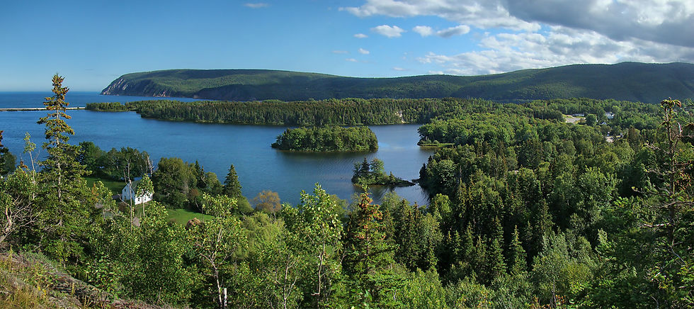
Discover Canada and Explore the Fossils and Geodiversity of Cape Breton Island in Nova Scotia
Cape Breton Island in north east Nova Scotia showcases over a billion years of Earth history through its striking geology and fossil heritage. Formed from four ancient terranes including the Blair River Complex, Aspy, Bras d’Or and Mira sutured together during continental collisions and uplifted in the Appalachian orogeny the island preserves remnants of tropical Carboniferous swamps. The Sydney Coalfield records 12 major coal seams formed from peat-rich forests dominated by Lepidodendron, Bothrodendron, and ferns now displayed at the Cape Breton Fossil Centre. Rare anthracosaur trackways near Creignish reveal early vertebrates from 320 million years ago.
Discover Canada and Explore the Fossils and Geodiversity of Joggins Fossil Cliffs in Nova Scotia
Joggins Fossil Cliffs in Nova Scotia, a UNESCO World Heritage Site and IUGS Geological Heritage Site, preserves one of the world’s most remarkable Carboniferous ecosystems along 14.7 km of the Bay of Fundy coast. The Joggins Formation, deposited near the equator during the Late Carboniferous (323–299 million years ago) within tropical swamps, delta channels and peat forests contains upright lycopsid trees and the earliest known reptile, Hylonomus lyelli, alongside diverse amphibians, giant arthropods like Arthropleura, and over 200 plant and animal species. Salt-tectonic-driven subsidence and rapid sedimentation preserved these fossil-rich strata.
Discover Canada and Explore the Geodiversity and Fossils of the Cliffs of Fundy UNESCO Global Geopark
The Cliffs of Fundy UNESCO Global Geopark, stretching 165 km along Nova Scotia’s north shore from Parrsboro to Apple River, offers a spectacular window into over 400 million years of Earth’s history. Designated in 2020, the geopark features towering red cliffs, basalt headlands, tidal estuaries, and fossil-rich formations like the Blomidon, McCoy Brook and Parrsboro Formations. Visitors can trace the earliest terrestrial tetrapod's, prosauropod dinosaurs, early crocodilians and amphibians through footprints and skeletal fossils while exploring landscapes shaped by the Acadian Orogeny, Triassic-Jurassic rifting and halokinetic salt tectonics.
Ontario
Discover Canada and Explore the Fossils and Geodiversity of the Niagara Escarpment in Ontario
The Niagara Escarpment of southern Ontario is a 725-kilometre Silurian-aged cuesta stretching from Niagara Falls to Tobermory through Hamilton and the Bruce Peninsula. Composed of dolostone and limestone from the Lockport, Rochester, and Grimsby formations, it records nearly 450 million years of Earth history. Formed by differential erosion above softer shales and sandstones, the escarpment features dramatic cliffs, waterfalls, and karst caves. Its ancient tropical seabed preserves rich Ordovician and Silurian fossils—corals, trilobites, crinoids, and the exceptional Eramosa Lagerstätte near Wiarton. Sculpted by glaciers and dissolution, the escarpment now supports Canada’s most biodiverse UNESCO Biosphere Reserve, where geology, palaeontology, and ecology converge in a landscape of striking natural beauty.
Discover Canada and Explore the Fossils and Geodiversity of the Bay of Quinte in Ontario
The Bay of Quinte in southeastern Ontario, along Lake Ontario’s northern shore near Belleville, Trenton, and Prince Edward County, reveals a 450-million-year-old marine past preserved in its Ordovician limestone and dolostone. Formed beneath the tropical Iapetus Ocean, the Black River and Trenton groups record nearshore to deep-shelf environments rich in trilobites, brachiopods, corals, bryozoans, and crinoids. These formations document the Caradoc Stage and the transition from carbonate to siliciclastic sedimentation during the Taconic Orogeny, marking the end of the Great American Carbonate Bank. Later shaped by the Laurentide Ice Sheet, the Bay of Quinte’s fossil-rich outcrops as seen at Presqu’ile, North Beach, and Wellington.
Prince Edward Island
Discover Canada and Explore the Fossils and Geodiversity of Prince Edward Island (PEI)
Prince Edward Island (PEI), Canada’s smallest province, reveals a vivid geological history through its iconic red sandstone cliffs formed 255–300 million years ago during the Late Carboniferous to Early Permian. These iron-rich Pictou Group redbeds comprising the Miminegash, Kildare Capes, and Hillsborough River formations were deposited in the Maritimes Basin as rivers flowed across tropical Pangean lowlands. Their oxidation produced PEI’s striking red hues, immortalized in Anne of Green Gables. Fossils of Dimetrodon borealis, early tetrapod trackways and plant remains such as Walchia and Paracalamites reveal a lush, evolving ecosystem transitioning from humid swamps to arid plains.
Québec
Discover Canada and Explore the Fossils and Geodiversity of Anticosti Island in Québec
Anticosti Island, at the mouth of Québec’s St. Lawrence River, is a globally significant fossil destination and UNESCO World Heritage Site renowned for its Late Ordovician Mass Extinction (LOME) and Early Silurian marine recovery. Stretching 222 km, the island exposes near-continuous carbonate sequences including the Ellis Bay, Vauréal, Gun River, Jupiter, and Becscie formations preserving diverse brachiopods, trilobites, corals, and rare soft-bodied organisms. Storm-generated tempestite beds have exquisitely preserved benthic communities in life position, documenting ecological collapse and recovery over nearly ten million years. Anticosti reveals reef development, biodiversity rebound and post-extinction ecosystem stabilisation, offering insights into ancient tropical marine environments.
Discover Canada and Explore the Fossils and Geodiversity of Miguasha National Park in Québec
Parc national de Miguasha on Québec’s Gaspé Peninsula, a UNESCO World Heritage Site since 1999, preserves the Late Devonian Escuminac Formation, a globally significant fossil lagerstätte documenting the fish-to-tetrapod transition. Exposed along Chaleur Bay, this ~120 m sequence of sandstones, shales, and mudstones preserves over 18,000 specimens, including iconic sarcopterygians like Eusthenopteron foordi and the nearly complete Elpistostege watsoni, whose limb-like fins reveal the evolutionary steps toward weight-bearing limbs. The site also captures placoderms, acanthodians, lungfish, and early terrestrial arthropods, providing a rare snapshot of estuarine ecosystems during the “Age of Fishes.”
Discover Canada and Explore the Percé UNESCO Global Geopark of the Gaspé Peninsula in Quebec
Percé UNESCO Global Geopark, located on Quebec’s Gaspé Peninsula where the Appalachians meet the Gulf of St. Lawrence and offers an extraordinary journey through nearly 500 million years of Earth history. Dominated by the Devonian limestone Percé Rock and the nearby Bonaventure Island seabird colonies, the 40 km² park showcases fossil-rich formations including the Upper Gaspé Limestone Series with brachiopods, trilobites, corals, and crinoids, the Matapédia Group with complex Ordovician-Silurian trace fossils, and the Carboniferous Bonaventure Formation is home to some of Canada’s oldest tetrapod trackways. Nearby Miguasha National Park preserves the Escuminac Formation, revealing the critical fish-to-tetrapod evolutionary transition.
Saskatchewan
Discover Canada and Explore the Fossils and Geodiversity of Eastend in Saskatchewan
Eastend, Saskatchewan, set within the dramatic Frenchman River Valley Badlands near the Cypress Hills Uplands, offers one of Canada’s most important windows into the final days of the dinosaurs. Exposed along the Missouri Coteau, the Bearpaw, Eastend, and Frenchman formations record the retreat of the Western Interior Seaway from 83 to 65 million years ago, transitioning from marine to terrestrial ecosystems. Marine shales with ammonites and mosasaurs give way to floodplain deposits rich in Tyrannosaurus rex, Triceratops, and early mammals such as Protungulatum. The discovery of “Scotty,” the world’s largest T. rex, cements Eastend’s global paleontological significance and highlights Saskatchewan’s remarkable Late Cretaceous fossil heritage.
Nunavut Territory
Discover Canada and Explore the Fossils and Geodiversity of Ellesmere Island in Nunavut Territory
Ellesmere Island in Nunavut’s Qikiqtaaluk Region preserves a globally significant fossil record spanning the Late Devonian to Eocene. The Fram Formation (~383–372 Ma) documents the water-to-land transition of vertebrates, highlighted by Tiktaalik roseae and diverse lobe-finned fishes, while the Eureka Sound Group and Margaret Formation (~52–54 Ma) reveal a warm, forested Arctic during the Eocene Thermal Maximum, hosting early primates like Ignacius mckennai, Arctic tapirs (Thuliadanta), alligators and giant tortoises. Rare Lower Cretaceous marine fossils, including Colymbosaurus, underscore Arctic marine connections. Situated within rugged mountains, glaciers, and Quttinirpaaq National Park, Ellesmere Island’s permafrost and erosion threaten these deposits, which are crucial for understanding vertebrate evolution in a high-latitude paleoclimate and past greenhouse ecosystem.
Yukon Territory
Discover Canada and Explore the Fossils and Geodiversity of Herschel Island in the Yukon
Herschel Island, or Qikiqtaruk, off northern Yukon in the Beaufort Sea, preserves a unique Pleistocene Arctic landscape formed around 30,000 years ago during the Wisconsin Glaciation. Composed of ice-rich Yedoma permafrost, the island continually exposes fossils of Ice Age megafauna, including woolly mammoths, Yukon horses, steppe bison, muskoxen, and American mastodons, alongside plant remains and pollen that reveal a “mammoth steppe” ecosystem. Part of Qikiqtaruk Territorial Park and the larger Beringian wilderness, the region functioned as an ice-free refugium, maintaining biodiversity and facilitating human and animal migration across the Bering Land Bridge. Thawing permafrost and coastal erosion both uncover invaluable fossils and highlight critical climate feedback processes, making Herschel Island a key site for understanding Arctic Pleistocene environments and megafaunal ecology.